
Assessing Resilience Of Buildings To Fire Risk
QUT researchers are currently conducting a LIDAR Scan of the Tamborine Memorial Hall. This was conducted as a part of the ‘Black Summer Project’ to improve the bushfire resilience of buildings in the Scenic Rim Regional Council.
The project aims to utilise advanced drone-based technology and computational heat transfer analyses to conduct building assessments and provide evidence-based retrofitting solutions to improve the resilience of buildings in future bushfires. The project investigators are Prof Mahen Mahendran, Dr Anthony Ariyanayagam, Prof Felipe Gonzalez, and Dr Ian Weir.
In essence, the project, funded by the Federal Government (Black Summer Grant), is to assess the resilience of buildings to fire risk following the country-wide devastating bushfires of 2020, especially in rural situations.
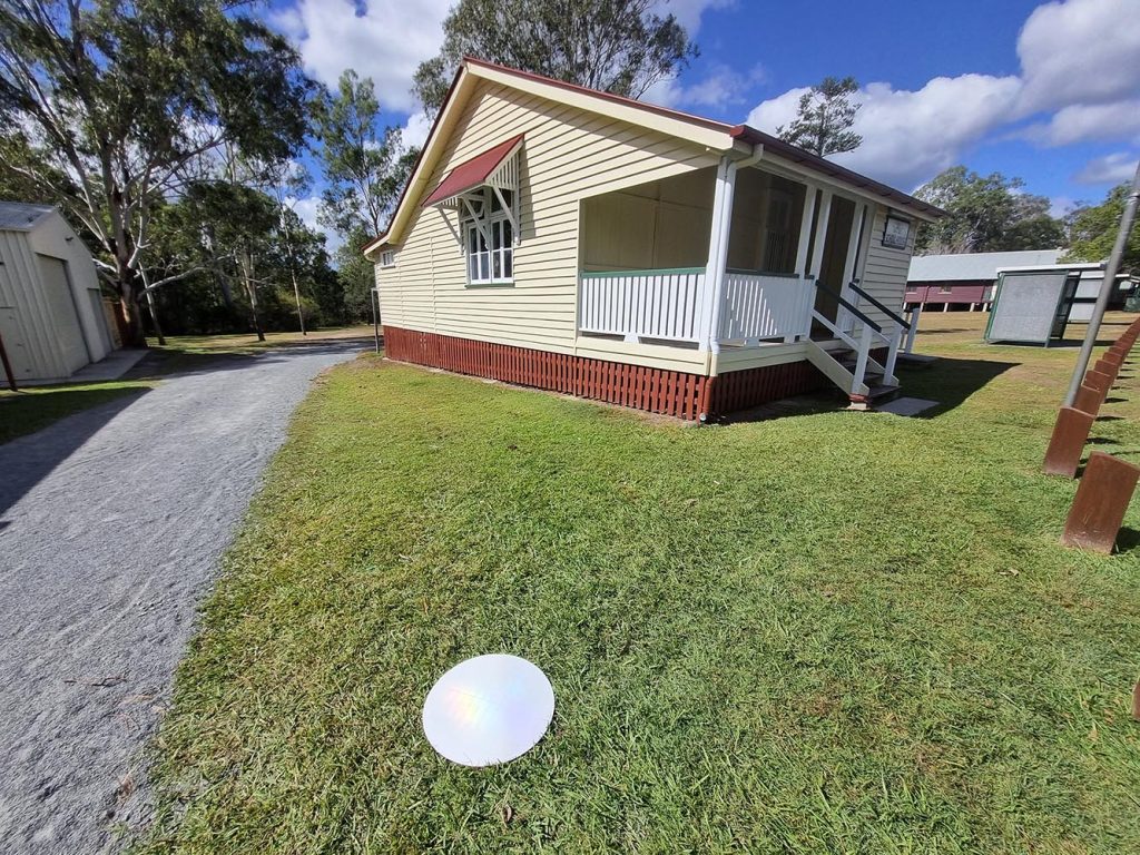
To this end, Tamborine Memorial Hall was selected for a LIDAR (Laser Imaging, Detection, And Ranging) scan to create a visual representation or ‘3D model image’ both internally and externally of the building using a Remotely Piloted Aircraft System (RPAS).
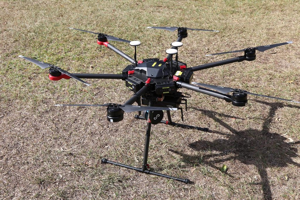
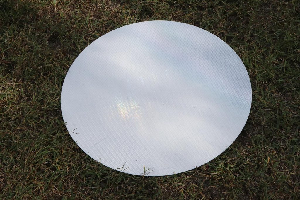
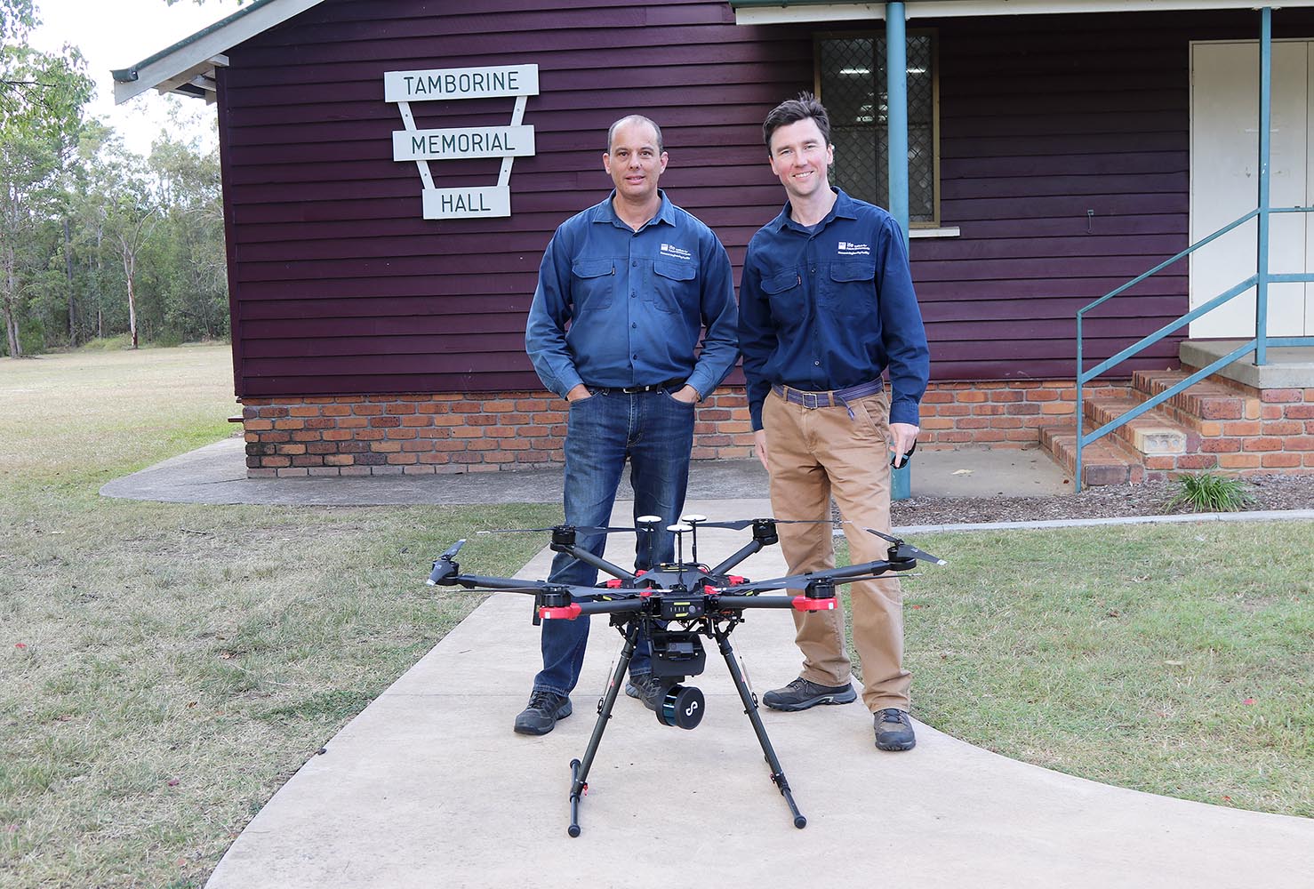
The 10kg Hexacopter M600 RPAS (drone) was piloted by QUT Design and RPAS Technician Gavin Broadbent and carried onboard a Brisbane-made LIDAR. The system conducts safe, fast and accurate mapping by emitting light beams towards the environment and receiving a return signal at the rate of 300000 pts/s. The GPS-RTK survey of circular specialised reflective Ground Control Points (GCP) markers allows an accurate georeferencing of the scan. A Go Pro with a wide angle camera also captures video for use in colourisation of the ‘3D model’. The survey, collection, and specific analysis of the data was led by Dr Dmitry Bratanov, QUT Research Engineer.
One of the most famous LIDAR scanned visual representations is of Old Government House. Please see: Old Government House video https://youtu.be/Q5odQwwYYA8 or use the QR code beside. Another was made of the University grounds during the Pandemic so students could visit the campus and take a ‘walk-thru’ in a ‘safe’ colourised 3D space.

Please Note: After completion of the survey, unfortunately, it was found one of the Ground Control Point (GCP) markers placed near the Little School House has disappeared.
The disc is extremely important to the survey work, so we are asking if it could please be returned to the Hall or to: QUT Da Vinci Precinct, 22-24 Boronia Rd, Brisbane Airport – no questions will be asked!